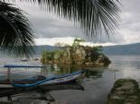
Jun 11, 2008

Taj Mahal


The Taj Mahal (pronounced /tɑʒ mə'hɑl/) (Persian: تاج محل), is a mausoleum located in Agra, India, that was built under Mughal Emperor Shah Jahan in memory of his favorite wife, Mumtaz Mahal.

The Taj Mahal (also "the Taj") is considered the finest example of Mughal architecture, a style that combines elements from Persian, Turkish, Indian, and Islamic architectural styles. In 1983, the Taj Mahal became a UNESCO World Heritage Site and was cited as "the jewel of Muslim art in India and one of the universally admired masterpieces of the world's heritage."

The Taj Mahal attracts from 2 to 4 million visitors annually, with more than 200,000 from overseas. Most tourists visit in the cooler months of October, November and February. Polluting traffic is not allowed near the complex and tourists must either walk from carparks or catch an electric bus. The Khawasspuras (northern courtyards) are currently being restored for use as a new visitor centre.The small town to the south of the Taj, known as Taj Ganji or Mumtazabad, originally was constructed with caravanserais, bazaars and markets to serve the needs of visitors and workmen.Lists of recommended travel destinations often feature the Taj Mahal, which also appears in several listings of seven wonders of the modern world, including the recently announced New Seven Wonders of the World, a recent poll with 100 million votes

For security reasons only five items - water in transparent bottles, small video cameras, still cameras, mobile phones and small ladies' purses - are allowed inside the Taj Mahal.

Ever since its construction, the building has been the source of an admiration transcending culture and geography, and so personal and emotional responses to the building have consistently eclipsed scholastic appraisals of the monument.

Ever since its construction, the building has been the source of an admiration transcending culture and geography, and so personal and emotional responses to the building have consistently eclipsed scholastic appraisals of the monument.

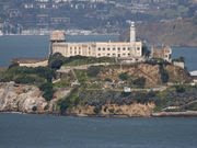
Jun 9, 2008

Alcatraz Island


In the 1800s American Indians prisoners were often held at the military prison on Alcatraz. In 1964, a year after the penitentiary closed, and again in 1969, Alcatraz was "liberated" by Indians of All Tribes, changing the course of U.S. history by helping to establish tribal rights of self determination. An award winning video/exhibit, WE HOLD THE ROCK, shows daily on Alcatraz Island in an exhibit area near the dock.

Alcatraz Island offers a close-up look at the site of the first lighthouse and US fort on the West Coast, the infamous federal penitentiary long off-limits to the public, and the 18 month occupation by Indians of All Tribes which saved the tribes. Rich in history, there is also a natural side to the Rock - gardens, tide pools, bird colonies, and bay views beyond compare

Alcatraz can be windy and cool, warm and clear, and wet (fog and rain) most any time of year - even on the same day! We recommended wearing layers as conditions can change quickly.

In general summers tend to be cool and foggy, winters cool and rainy, but nice days can happen any time of year.

"The coldest winter I ever spent was a summer in San Francisco."

By decision of US Attorney General Robert F. Kennedy, the penitentiary was closed for good on March 21, 1963. It was closed because it was far more expensive to operate than other prisons (nearly $10 per prisoner per day, as opposed to $3 per prisoner per day at Atlanta),[7] half a century of salt water saturation had severely eroded the buildings, and the bay was being badly polluted by the sewage from the approximately 250 inmates and 60 Bureau of Prisons families on the island. The United States Penitentiary in Marion, Illinois, a new, traditional land-bound prison opened that same year to serve as a replacement for Alcatraz.

The lost city of Petra


Petra was first established sometime around the 6th century BC, by the Nabataean Arabs, a nomadic tribe who settled in the area and laid the foundations of a commercial empire that extended into Syria. Despite successive attempts by the Seleucid king Antigonus, the Roman emperor Pompey and Herod the Great to bring Petra under the control of their respective empires, Petra remained largely in Nabataean hands until around 100AD, when the Romans took over. It was still inhabited during the Byzantine period, when the former Roman empire moved its focus east to Constantinople, but declined in importance thereafter. The Crusaders constructed a fort there in the 12th century, but soon withdrew, leaving Petra to the local people until the early 19th century, when it was visited by the Swiss explorer Johann Ludwig Burckhardt.

Petra lies about 3-5 hours south of modern Amman, about 2 hours north of Aqaba, on the edges of the mountainous desert of the Wadi Araba. The city is surrounded by towering hills of rust-coloured sandstone which gave the city some natural protection against invaders.

From the official entrance to the site, a dusty trail leads gently downwards along the Wadi Musa (The Valley of Moses). Situated in small rock outcrops to the left and right of the path are some small Nabataean tombs, carved into the dry rock. Beyond these, walls of sandstone rise steeply on the left, and a narrow cleft reveals the entrance to the Siq, the principal route into Petra itself.

The Nabataeans were expert hydraulic engineers. The walls of the Siq are lined with channels (originally fitted with chamfered clay pipes of efficient design) to carry drinking water to the city, while a dam to the right of the entrance diverted an adjoining stream through a tunnel to prevent it flooding the Siq.

Once inside, the Siq narrows to little more than five metres in width, while the walls tower up hundreds of metres on either side. The floor, originally paved, is now largely covered with soft sand, although evidence of Nabataean construction can still be seen in some places.

The Siq twists and turns, the high walls all but shutting out the early morning sunlight, until abruptly, through a cleft in the rock , the first glimpse of the city of Petra can be seen. Carved out of pale reddish sandstone, ornate pillars supporting a portico surmounted by a central urn and two flanking blocks, jut out from the cliff face ahead. This is The Khazneh ...


Jun 7, 2008

Eiffel Tower


The Eiffel Tower (French: Tour Eiffel, /tuʀ ɛfɛl/) is an iron tower built on the Champ de Mars beside the Seine River in Paris. The tower has become a global icon of France and is one of the most recognizable structures in the world.

The structure was built between 1887 and 1889 as the entrance arch for the Exposition Universelle, a World's Fair marking the centennial celebration of the French Revolution. Eiffel originally planned to build the tower in Barcelona, for the Universal Exposition of 1888, but those responsible at the Barcelona city hall thought it was a strange and expensive construction, which did not fit into the design of the city. After the refusal of the Consistory of Barcelona, Eiffel submitted his draft to those responsible for the Universal Exhibition in Paris, where he would build his tower a year later, in 1889. The tower was inaugurated on March 31, 1889, and opened on 6 May. Three hundred workers joined together 18,038 pieces of puddled iron (a very pure form of structural iron), using two and a half million rivets, in a structural design by Maurice Koechlin. The risk of accident was great, for unlike modern skyscrapers the tower is an open frame without any intermediate floors except the two platforms. However, because Eiffel took safety precautions, including the use of movable stagings, guard-rails and screens, only one man died.

Eiffel Tower Construction view: girders at the first story

The tower was met with much criticism from the public when it was built, with many calling it an eyesore. Newspapers of the day were filled with angry letters from the arts community of Paris. One is quoted extensively in William Watson's US Government Printing Office publication of 1892 Paris Universal Exposition: Civil Engineering, Public Works, and Architecture. “And during twenty years we shall see, stretching over the entire city, still thrilling with the genius of so many centuries, we shall see stretching out like a black blot the odious shadow of the odious column built up of riveted iron plates.”[10] Signers of this letter included Messonier, Gounod, Garnier, Gerome, Bougeureau, and Dumas.

Novelist Guy de Maupassant — who claimed to hate the tower — supposedly ate lunch in the Tower's restaurant every day. When asked why, he answered that it was the one place in Paris where you couldn't see the Tower. Today, it is widely considered to be a striking piece of structural art.

One of the great Hollywood movie clichés is that the view from a Parisian window always includes the tower. In reality, since zoning restrictions limit the height of most buildings in Paris to 7 stories, only a very few of the taller buildings have a clear view of the tower..

Eiffel had a permit for the tower to stand for 20 years, meaning it would have had to be dismantled in 1909, when its ownership would revert to the City of Paris. The City had planned to tear it down (part of the original contest rules for designing a tower was that it could be easily demolished) but as the tower proved valuable for communication purposes, it was allowed to remain after the expiration of the permit. The military used it to dispatch Parisian taxis to the front line during the First Battle of the Marne, and it therefore became a victory statue of that battle.

Tower of Pisa


The Leaning Tower of Pisa (Italian: Torre pendente di Pisa) or simply The Tower of Pisa (La Torre di Pisa) is the campanile, or freestanding bell tower, of the cathedral of the Italian city of Pisa. It is situated behind the Cathedral and it is the third structure by time in Pisa's Piazza del Duomo (Cathedral Square).

Although intended to stand vertically, the tower began leaning to the southeast soon after the onset of construction in 1173 due to a poorly laid foundation and loose substrate that has allowed the foundation to shift direction.

The height of the tower is 55.86 m (183.27 ft) from the ground on the lowest side and 56.70 m (186.02 ft) on the highest side. The width of the walls at the base is 4.09 m (13.42 ft) and at the top 2.48 m (8.14 ft). Its weight is estimated at 14,500 tonnes. The tower has 296 or 294 steps; the seventh floor has two fewer steps on the north-facing staircase. The tower leans at an angle of 3.97 degrees[1]. This means that the top of the tower is 3.9 meters from where it would stand if the tower were perfectly vertical.
is said to have dropped two cannon balls of different masses from the tower to demonstrate that their descending speed was independent of their mass. This is considered an apocryphal tale, and the only source for it comes from Galileo's secretary.[7]

In 1934 Benito Mussolini ordered that the tower be returned to a vertical position, so concrete was poured into its foundation. However, the result was that the tower actually sank further into the soil.[8]

During World War II, the Allies discovered that the Nazis were using it as an observation post. A U.S. Army sergeant was briefly entrusted with the fate of the tower. His decision not to call in an artillery strike saved the edifice.[8]

On February 27, 1964, the government of Italy requested aid in preventing the tower from toppling. It was, however, considered important to retain the current tilt, due to the vital role that this element played in promoting the tourism industry of Pisa. [9] A multinational task force of engineers, mathematicians and historians was assigned and met on the Azores islands to discuss stabilization methods. It was found that the tilt was increasing due to the stonework expanding and contracting each day due to the heat of sunlight[10]. This was working in combination with the softer foundations on the lower side. Many methods were proposed to stabilize the tower, including the addition of 800 metric tons of lead counterweights to the raised end of the base.[11]

On 7 January 1990, after over two decades of work on the subject, the tower was closed to the public. While the tower was closed, the bells were removed to relieve some weight, and cables were cinched around the third level and anchored several hundred meters away. Apartments and houses in the path of the tower were vacated for safety. The final solution to prevent the collapse of the tower was to slightly straighten the tower to a safer angle, by removing 38 m3 of soil from underneath the raised end. The tower was straightened by 18 inches (45 centimetres), returning to the exact position that it occupied in 1838. After a decade of corrective reconstruction and stabilization efforts, the tower was reopened to the public on December 15, 2001, and has been declared stable for at least another 300 years.[11]

In 1987, the tower was declared as part of the Piazza dei Miracoli UNESCO World Heritage Site along with neighbouring cathedral, baptistery and cemetery.

In May 2008, after the removal of another 70 tonnes of earth, engineers announced that the Tower had been stabilized such that it had stopped moving for the first time in its history. They stated it would be stable for at least 200 years.

Eifel


The Eifel is a low mountain range in western Germany. It occupies parts of southwestern North Rhine-Westphalia and northwestern

The Eifel is bordered by the Mosel River in the south and the Rhine in the east. In the north it is limited by the hills of the High Fens (Hohes Venn), in the west by the Ardennes of Belgium and Luxemburg.

  • Since 2004 about 110 km² of the Eifel have been protected as the nature reserve Eifel National Park.
  • The Nürburg Ring, one of the world's most famous motor racing courses, is located in the Eifel. The northern loop (Nordschleife) of the course is also known as the Green Hell (Grüne Hölle), because of its long, difficult and dangerous path through the local forest.
  • An interesting archeological feature of the region is the Eifel Aqueduct, one of the longest aqueducts of the Roman empire, providing the city of Cologne with water.

Great Wall of China


The Chinese were already familiar with the techniques of wall-building by the time of the Spring and Autumn Period, which began around the 7th century BC. During the Warring States Period from the 5th century BC to 221 BC, the states of Qi, Yan and Zhao all constructed extensive fortifications to defend their own borders. Built to withstand the attack of small arms such as swords and spears, these walls were made mostly by stamping earth and gravel between board frames. Qin Shi Huang conquered all opposing states and unified China in 221 BC, establishing the Qin Dynasty. Intending to impose centralized rule and prevent the resurgence of feudal lords, he ordered the destruction of the wall sections that divided his empire along the former state borders. To protect the empire against intrusions by the Xiongnu people from the north, he ordered the building of a new wall to connect the remaining fortifications along the empire's new northern frontier. Transporting the large quantity of materials required for construction was difficult, so builders always tried to use local resources. Stones from the mountains were used over mountain ranges, while rammed earth was used for construction in the plains. There are no surviving historical records indicating the exact length and course of the Qin Dynasty walls. Most of the ancient walls have eroded away over the centuries, and very few sections remain today. Later, the Han, Sui, Northern and Jin dynasties all repaired, rebuilt, or expanded sections of the Great Wall at great cost to defend themselves against northern invaders.

The Great Wall concept was revived again during the Ming Dynasty following the Ming army's defeat by the Oirats in the Battle of Tumu in 1449. The Ming had failed to gain a clear upper-hand over the Manchurian and Mongolian tribes after successive battles, and the long-drawn conflict was taking a toll on the empire. The Ming adopted a new strategy to keep the nomadic tribes out by constructing walls along the northern border of China. Acknowledging the Mongol control established in the Ordos Desert, the wall followed the desert's southern edge instead of incorporating the bend of the Huang He.

Unlike the earlier Qin fortifications, the Ming construction was stronger and more elaborate due to the use of bricks and stone instead of rammed earth. As Mongol raids continued periodically over the years, the Ming devoted considerable resources to repair and reinforce the walls. Sections near the Ming capital of Beijing were especially strong.[7]

Towards the end of the Shun Dynasty, the Great Wall helped defend the empire against the Manchu invasions that began around 1600. Under the military command of Yuan Chonghuan, the Ming army held off the Manchus at the heavily fortified Shanhaiguan pass, preventing the Manchus from entering the Liaodong Peninsula and the Chinese heartland. The Manchus were finally able to cross the Great Wall in 1644, when the gates at Shanhaiguan were opened by Wu Sangui, a Ming border general who disliked the activities of rulers of the Shun Dynasty. The Manchus quickly seized Beijing, and defeated the newly founded Shun Dynasty and remaining Ming resistance, to establish the Qing Dynasty


Under Qing rule, China's borders extended beyond the walls and Mongolia was annexed into the empire, so construction and repairs on the Great Wall were discontinued. A counterpart wall to the Great Wall in the south was erected to protect and divide the Chinese from the 'southern barbarians' called Miao (meaning barbaric and nomadic)

Bukittinggi


Bukittinggi (Indonesian for "high hill") is one of the larger cities in West Sumatra, Indonesia, with a population of over 91,000 people and an area of 25.24 km². It is situated in the Minangkabau highlands, 90 km by road from the West Sumatran capital city of Padang

The city has its origins in five villages which served as the basis for a marketplace.[1]

The city was known as Fort de Kock during colonial times in reference to the Dutch outpost established here in 1825 during the Padri War. The fort was founded by Captain Bauer at the top of Jirek hill and later named after the then Lieutenant Governor-General of the Dutch East Indies, Hendrik Merkus de Kock.[2] The first road connecting the region with the west coast was built between 1833 and 1841 via the Anai Gorge, easing troop movements, cutting the costs of transportation and providing an economic stimulus for the agricultural economy.[3] In 1856 a teacher-training college (Kweekschool) was founded in the city, the first in Sumatra, as part of a policy to provide educational opportunities to the indigenous population.[4] A rail line connecting the city with Payakumbuh and Padang was constructed between 1891 and 1894.[5]

It is a city popular with tourists due to the climate and central location. Attractions within the city include:
  • Ngarai Sianok (Sianok Canyon)
  • Lobang Jepang (Japanese Caves) - a network of underground bunkers & tunnels built by the Japanese during World War II
  • Jam Gadang - a large clock tower built by the Dutch in 1926.
  • Pasar Atas and Pasar Bawah markets
  • Taman Bundo Kanduang park. The park includes a replica Rumah Gadang (literally: big house, with the distinctive Minangkabau roof architecture) used as a museum of Minangkabau culture, and a zoo. The Dutch hilltop outpost Fort de Kock is connected to the zoo by the Limpapeh pedestrian overpass.

Notable nearby destinations include Lake Maninjau and the Harau Valley.

Bunaken


Bunaken is one of Indonesia's most famous dive areas, and it draws scuba divers from all over the world. In addition to Bunaken itself, a rather featureless banana-shaped island, the national park includes the neighboring islands of Manado Tua, a distinctive cone-shaped extinct volcano, Siladen,Montehagen, Nain and Nain Kecil.

The park is famed for the clarity of its water (35m visibility is common in the summer dry season), the abundance of coral and fish, and for the precipitous "walls" at some sites. Bunaken Timur, right off the east coast of the island and featuring all of the above, is according to some the best dive site in all Indonesia.

Except for the very largest pelagics, nearly everything can be found at Bunaken. Reef inhabitants include white and black tip reef sharks, giant sea turtles, napoleonfish and dugongs.

You may frequently run into dolphins, and occasionally schools of whales

Bunaken is barely a degree above the equator and thus tropical. The "Rainy Season" from November to mid April, brings frequent rains, sometimes in storms lasting for several days, which make the air nice and cool but also reduce visibility. The "Dry Season" from May to October, when temperatures climb to 35° and visibility reaches a maximum. Bunaken receives far less rain than the mainland and is well ventilated with sea breezes.

At the "Visitors Center" on Liang beach locals sell handicrafts, T Shirts and general souvenirs
Fish, fish and fish -- usually at your dive resort.
Natural drinking water is Not available on Bunaken. Insist on bottled mineral water at all times, ensure that coffees or teas are made using bottled water also. Local spirits Cap Tikus literally "rat brand" made from distilled palm wine (a type of moonshine), actually quite nice "on the rocks with a slice of lemon".

Lake Toba


Lake Toba is an immense volcanic lake covering area 1707 sq km (bigger than Singapore) with an island in the center. Formed by a gigantic volcanic eruption some 70,000 years ago, it is probably the largest resurgent caldera on Earth. Some studies say it might have been associated with causing previous ice age/climate change.

The island in the middle - Pulau Samosir - was joined to the caldera wall by a narrow isthmus, which was cut through to enable boats to pass; a road bridge crosses the cutting. You get a ferry from Parapat to Pulau Samosir Island, they run every 1-2 hours, the last one at 7:30pm (Rp 7000). Self proclaimed 'Tourist Hunters' may befriend you on the boat but are harmless and often helpful to find things, arrangements etc (Bintang can fix you up with anything). Tuk Tuk is the main town to stay on Samosir.

Lake Toba used to be popular tourist destination but now not many tourist come, which means many services, no crowds, cheap prices and friendly locals grateful for your business. It is a great laid back place to chill out for a few days after jungle trekking etc. The location is very popular with Chinese tourists around the Chinese New Year, when availability drops dramatically and accommodation costs are known to sky rocket.

Mount Rinjani


Mount Rinjani or Gunung Rinjani is an active volcano in Indonesia on the island of Lombok. It rises to 3,726 m (12,224 ft), making it the second highest volcano in Indonesia. The first historical eruption occurred in September of 1847. The most recent eruption of Mount Rinjani was on 1 October 2004. The volcano and spectacular Segara Anak crater lake, are protected by a national park established in 1997. The 6 km by 8.5 km oval-shaped caldera is filled partially by a lake known as Segara Anak (approximately 2000m above sea level and estimated at being between 200m and 300m deep); the caldera also contains hot springs. The eruptions of 1994, 1995, and 1996 have formed a small cone, Gunung Baru (or Mountain New - approximately 2300m above sea level) in the center of the caldera and lava flows from these eruptions have entered the lake.

The highlands are forest clad and mostly underdeveloped. The lowlands are highly cultivated. Rice, soybeans, coffee, tobacco, cotton, cinnamon, and vanilla are the major crops grown in the fertile soils of the island.

Tourism is also increasingly popular with trekkers able to visit the rim, make their way into the caldera or even to make the more arduous climb to the highest point; fatalities, however, are not uncommon

BALI


The amazing fertility of the Balinese soil has since ever given the Balinese a lot of leisure time, aside from their work as peasants, and stimulated their imagination and creativity. So much that the concept of “art” did not exist in their minds! Doing “artistic” things was such a routine to them, an ordinary activity, not more and not less then planting rice or feeding a young child. Until nowadays the offerings they prepare daily are somehow small pieces of art, but nobody minds if people step over them or dogs eat them.

Borobudur Temple


Overlooking the fertile valley of Magelang and facing the volcano Merapi, 40 km north from the province of Jogjakarta, stands a breathtaking monument that was built during the 8th century by the Bouddhist dynasty of Sailendra.

This is the most prestigious monument in Indonesia, and the world’s largest Buddhist temple. The different levels of the monument symbolizes the different levels of wisdom we have to go through during life until reaching the enlightenment of Buddha, symbolized by the spectacular upper terraces.

The global architecture (obvious when seen from the air) is actually a mandala (sacred diagrams initiating people with spiritual awareness). Borobudur is the place where you may find a new vision of the world…and yourself.